Getting location right: from meter to cm positioning accuracy

Prototyping a low-cost continuous GNSS monitoring network for positioning and atmospheric purposes in Ghana Imagine you bought a plot of land and need to map the exact boundaries. However, your positioning device (often referred to as GPS) can only measure up to several meters of accuracy unless you rent a very expensive positioning instrument. This […]
Report on Citizen Scientist Training in Nakasongola District, Kalungi and Lwabwata Sub-counties

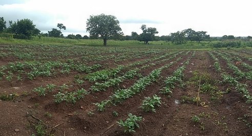
Background Work package 4 (Biosphere), one of the 4 main TWIGA work packages implemented at Makerere university focuses on monitoring vegetation in general and crop development in particular, coinciding with the sixth objective to produce accurate maps of land cover, land use, and crop status. However, because African agriculture is characterized by small-scale and mixed […]
SAR-derived water vapor maps for meteorological applications: processing advancement.

Numerical Weather Prediction Models (NWPM) can significantly benefit from the ingestion of SAR-derived products like water vapor maps. In particular, the contribution of SAR data to NWPM forecasts can be very effective if two conditions are satisfied: the estimated water vapor maps must be ‘dense’ and they must cover wide areas. Water vapor maps are […]
How many ground observations should we aim at?

TWIGA focuses on the combination of remote sensing data and ground-based observations to run models and develop products. The quality and amount of ground-based observations determine the accuracy of data that is used for satellite calibration and modeling, such as crop models. Maintaining monitoring networks requires high resources, thus it is important to assess where […]
Disdro in Kenya – Rain Listening Sensors

In Narok, Kenya there is a unique network of rain sensors on the experiment. We call it the Disdro Network – a network of acoustic devices that measures the distribution and intensity of rainfall. In December 2020, 10 Disdros were installed on an area spanning 1700km2. A few more are scheduled for installation in early […]
Using drones to get insight into field-scale moisture status
Within the TWIGA project, a student from Wageningen University, Kim Faassen, took up an internship with FutureWater to complete her MSc specialisation Meteorology and Air Quality. We asked Kim to develop a spatial evapotranspiration (ET) product based on a simple method and requiring few data inputs that can be obtained from satellites and drone flights. […]
UNIVERSAL AND INCLUSIVE ACCESS TO GEOSPATIAL INFORMATION FOR INCREASED PRODUCTION AND PRODUCTIVITY IN AGRICULTURE AND WATER
There is a lot of attention for digitalization for rural development (see for example the IT4D publication), however the sustainable increase of production and productivity in agriculture and water with the help of digitalization has not reached scale yet. The current wisdom is that this is most likely because most farmers in developing countries are […]
Coping with ionospheric disturbances in sub-Saharan Africa for GNSS meteorological applications

At the end of 2019, TWIGA shipped 6 low-cost GPS stations to Uganda. These were deployed in and around Kampala by Makerere University, with the support of GReD, PoliMi, Makerere University, and TU Delft. The purpose was to derive estimates of tropospheric Zenith Total Delay (ZTD), a parameter useful for meteorological applications. The use of […]
Transboundary Water Management made easier using the TWIGA platform

Currently, only around 58% of Africans have access to safe drinking water. More than 90% of African freshwater is contained within 63 internationally shared basins. The current freshwater distribution in Africa is expected to change rapidly due to climatic- and socio-economic drivers (IPCC, 2014). In order to guarantee access to freshwater for drinking water or […]
