How hot is the soil?

The Surface Energy Budget While the sun is beating down on the Earth’s surface, it is generating fluxes of energy that play an important role in determining our weather and climate. In a way, it functions as a gigantic solar panel that absorbs solar radiation. The absorbed energy can be either emitted back to the […]
TWIGA Disdro Network: How is it going in Kenya
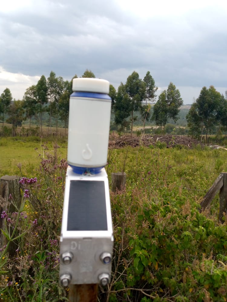
My last blog was on how we developed Kenya’s disdro network, how the sensors work and how we transmit its data. The network with the new generation of the disdro sensors has now been running continuously for 6 months. We are now shifting focus on keeping the network active and, more importantly, share and display […]
DIGITAL BUILDING BLOCKS TO GO BEYOND PILOTS FOR FOOD SECURITY

Most geodata applications for food security are still in the pilot stage. Geodata specialists tend to look to general digitalization initiatives for inspiration. The idea is to learn from them as they started earlier and are supposedly more advanced. Is this true? Apparently not, if you look at the latest World Bank report on digital […]
GEODATA FOR AGTECH AND FINTECH

There is quite some interest in geodata applications for inclusive finance for smallholder farmers. The idea is that financial institutions can make their operations more effective and more efficient. Geodata companies are looking for a combination of new markets and solving societal problems. Applications are credit scoring, assessment of repayment rate and time, geo-location of […]
Using the South African GNSS network to monitor country-wide atmospheric water vapour

The South African GNSS network (TrigNet, website) counts 64 stations distributed all over the country, with inter-station distances ranging from 80 km to 300 km. The network provides users with data for both real-time and post-processing applications. An example of real-time service is the provision of RTK corrections to augment the positioning precision of the […]
Flood Mapping: Case of Narok County, Kenya
Floods, described as the overflow of water in a particular region that is normally dry due to heavy rainfall or other weather-related events by Doswell III. 94% of all hazard-related economic damages are caused by floods, thus providing an incentive to look into it. Narok county, specifically Narok town is a town that is located […]
Getting location right: from meter to cm positioning accuracy

Prototyping a low-cost continuous GNSS monitoring network for positioning and atmospheric purposes in Ghana Imagine you bought a plot of land and need to map the exact boundaries. However, your positioning device (often referred to as GPS) can only measure up to several meters of accuracy unless you rent a very expensive positioning instrument. This […]
Report on Citizen Scientist Training in Nakasongola District, Kalungi and Lwabwata Sub-counties

Background Work package 4 (Biosphere), one of the 4 main TWIGA work packages implemented at Makerere university focuses on monitoring vegetation in general and crop development in particular, coinciding with the sixth objective to produce accurate maps of land cover, land use, and crop status. However, because African agriculture is characterized by small-scale and mixed […]
SAR-derived water vapor maps for meteorological applications: processing advancement.

Numerical Weather Prediction Models (NWPM) can significantly benefit from the ingestion of SAR-derived products like water vapor maps. In particular, the contribution of SAR data to NWPM forecasts can be very effective if two conditions are satisfied: the estimated water vapor maps must be ‘dense’ and they must cover wide areas. Water vapor maps are […]
