TWIGA acknowledges the important role of vegetation in the hydrological cycle. The vegetation monitoring is being done to monitor growth in the rainy and the dry seasons using an Open Data Kit (ODK) App (VegMon). This therefore entails citizen science – collecting data and analyzing it with farmers and teachers to support agriculture.
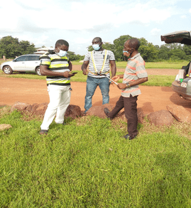
Selected participants, mainly TAHMO host teachers across Ghana were trained through a (one-on-one) training of trainers’ workshop while adhering strictly to all COVID-19 protocols to help collect data from their communities and to train others (farmers) in the use of the App. Each trainer was asked to take pictures of the vegetation around them using at least five (5) sites. The site could be a grassland, garden or a farm.
Currently, there are 15 data collectors (trainers) trained in Ghana to help with the Vegetation Monitoring. At the end of this month, we hope to have a total number of 20 participants. The current locations where the vegetation monitoring is being carried out includes Nyankpala, Sirigu, Navrongo, Nalerigu, Walewale, Bongo, Prang and Atebubu. The rest are Akwatia, Nkawkaw, Nsoatre, Bibiani, Kumasi, Sampa and Hwidiem. These trainers are spread across the country to give a wider view of the vegetation in Ghana to compliment the Sentinel-2 vegetation mapping led by the Helmholtz Centre for Environmental Research (UFZ).
Training participant from Akwatia 
Training participants from Nsoatre and Sampa 
Training participant from Nkawkaw
Written by Kwame Duah Anhwere
TAHMO
