VegMon: Smartphone-assisted citizen sensing for vegetation monitoring
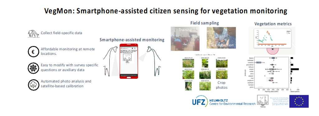
The VegMon app is based on the ODK platform. Using an interface, users can enter variables such as crop type through selection choices, photographs, GPS coordinates, as well as dates for planting and harvesting through calendar functions as well as manually measured plant heights and text comments. The VegMon app can be used by citizen scientists to monitor crop status.
The rainy season in Sub-Saharan Africa coincides with regular cloud cover that results in satellite data gaps during long periods of the crop growing seasons. In addition, African smallholder farmers frequently practice intercropping that is not yet distinguishable by current satellite products, even at the rather high-resolution of commonly available satellite data (e.g. ~10m, Sentinel 2A).
To still sustain data collection for crop modelling smartphone apps will be used to monitor crop properties. As smartphones do not feature the same sensor arrays that are available onboard satellites, vegetation metrics were selected, that can be derived from regular photos. The collected pictures are converted into metrics, such as greenness indices and canopy cover.
Graphical abstract
Link to services
Citizen sensing is a low-cost monitoring sensor. TWIGA services that require questionnaire-based data including image and geolocation information can benefit from this type of monitoring. Specific applications of VegMon are in the field of crop information systems, crop insurance, as well as crop monitoring that require filed data for calibration.
Publications
Ahmed, Shakir and Jan Friesen. “Farmers see where the satellite is blind – using citizen science to fill satellite-derived vegetation data gaps” EGU General Assembly 2020, Online, 4–8 May 2020, EGU2020-13145, See Here, 2020
Olango, Nicholas. “Report on Citizen Scientist Training in Nakasongola District, Kalungi and Lwabwata Sub-counties” In TWIGA blog (here)
