Within TWIGA, in situ GNSS time series and satellite SAR maps of atmospheric water vapor contents will be used to enhance the predictability of convective storms.
This will be achieved by assimilating these products into Numerical Weather Prediction Models (NWP).
The Weather and Research Forecasting (WRF) model has been selected to perform the assimilation experiments. Sensitivity tests on the setup of the model for the prediction of heavy rain events in tropical regions are needed to account for the specific weather dynamics of those areas.
Two case studies of heavy rains in southern Africa region have been selected: January 2017 and March 2018, by looking at the Floodlist archive. A validation against in situ observations, from TAHMO network and from the SAWS network, both available through the HydroNet platform will follow.
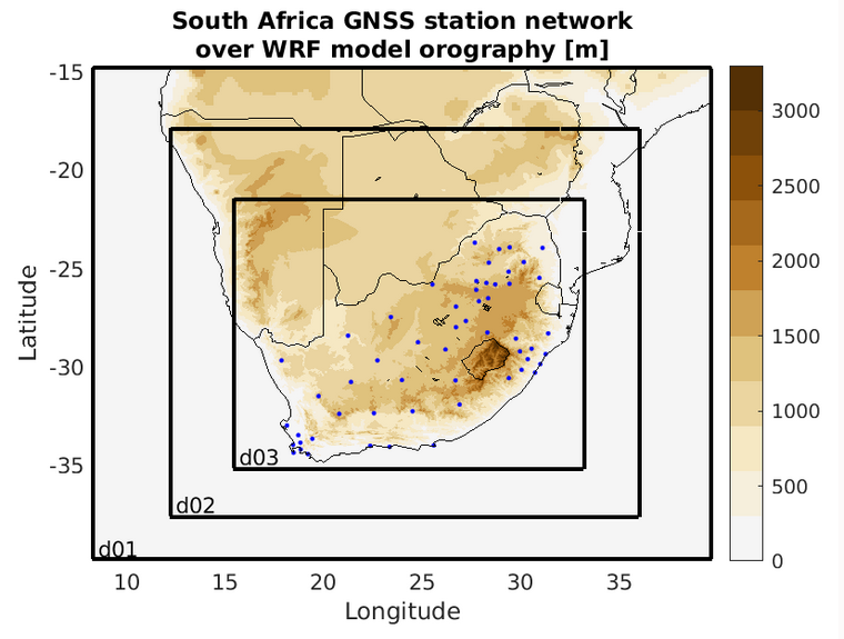
horizontal resolutions and the location of all the geodetic stations available.
The color shading shows the model orography
For the selected events, data from available GNSS permanent stations have been processed obtaining time series of atmospheric delays. These products will be used for the next assimilation experiments.

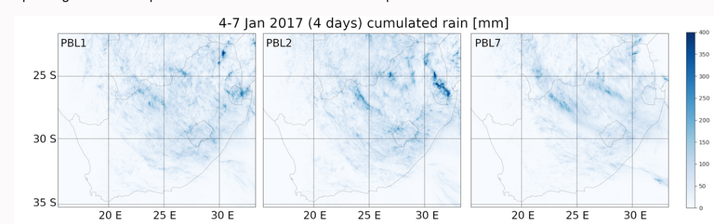
in the area of the heavy precipitation event in January 2017.
Preliminary results on sensitivity tests consist of cumulated rain maps for three different turbulence schemes. By comparing these predictions with corresponding observed maps we will be able to select the best setup.
Written by Giovanna Venuti
