Weather affects everything. It is both an essential resource and a significant risk factor for life on Earth. What’s more, the weather is one of the most unpredictable aspects of human existence, yet we have no choice but to try our hand at predicting it. After all, our very lives depend on our having ample supplies of foodstuffs that are themselves dependent on adequate precipitation, growing seasons and so forth. Weather is no small matter. Many businesses are directly or indirectly linked with weather conditions. For instance, agriculture relies on perfect weather forecasting for when to plant, irrigate and harvest.
Farmers are highly vulnerable to weather shocks, particularly in Africa, where there is a high reliance on rain-fed agriculture. It is therefore unsurprising that much attention has been paid to developing climate risk management tools for farmers to mitigate and transfer the risk of weather shocks such as drought and flood. Small farms are vulnerable to climate risk, but most smallholder farmers around the world don’t have access to insurance and other financial tools to manage fluctuations in climate.
Insurance is one way to increase resilience to climate shocks, but not only in the way you might think. There’s a subtler benefit to agriculture insurance, and one that is essential for adapting our food systems to a changing climate: when farmers feel financially secure, they’re more likely to take productive risks. In the decades to come, we can expect increasingly difficult growing seasons for farmers, and so taking advantage of good years will become more and more important – for both our food supply and farmers’ livelihoods. In recent years, agricultural insurance has become part research Actuarial Science program, particularly weather index-based insurance (WII). The interesting aspect has been that, rather than compensating observed damage, compensation in WII is determined on the basis of an independent index (such as the cumulative precipitation falling in a certain window of time or the average yield over a district).
The agriculture insurance, called weather index insurance, will provide a way to fill the insurance gap by basing payouts on weather and satellite data instead of expensive site visits from claims adjusters. This will be an addition to already developed Livestock indexed based insurance by ILRI researchers. The indexed based crop insurance will protect farmers against financial risks posed by extreme weather
events and has been widely advocated as a tool to help farmer households to escape poverty traps and invest in climate-smart high-productivity agriculture. Over the past decade, there has been a great deal of effort placed into index insurance–that may have the potential to reach these farmers. Unlike more traditional forms of insurance, which require individual verification of losses, index insurance works by providing payouts when a measurable index flags a major problem that the farmers face, such as a widespread drought or flood. In theory, this should allow insurance coverage to reach many more farmers
Index insurance is innovative, but can it reach a critical mass using Satellite data provided by TWIGA?
Transforming Weather Information Growth In Africa – TWIGA is a 4-year project (2018 – 2021) under EU Horizon2020 aimed to transform weather water data into value-added information services.
Satellite data provide by TWIGA will give index insurance the scaling power needed to reach all the small scale farmers across Africa. A Kenyan Insurance sector stakeholders workshop will be held this first quarter of 2019 to address the challenges available in implementing weather-indexed based insurance. The theme of the workshop will be: Index insurance is innovative, but can it reach a critical mass using Satellite data provided by TWIGA? This could be the start of touching the livelihoods of millions of smallholder farmers across the African continent that are under threat from extreme weather events, such as droughts and floods with risks projected to increase significantly in future years due to climate change.
Developers require the ability to easily combine weather functionality, including forecast and observational data, with numerous data and application services to build advanced web and mobile applications that leverage cognitive capabilities, analytics, mobile, and IoT services without wasting cycles installing or managing software and deploying hardware.
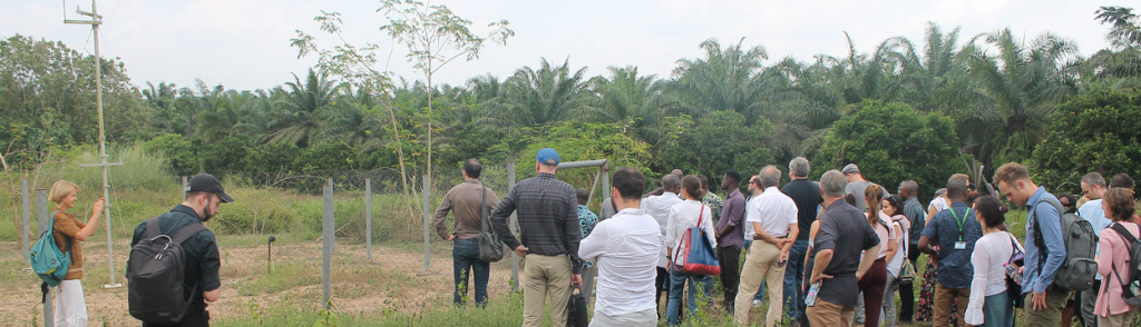
In conclusion, remotely sensed data can be used to extend weather index insurance to millions of farmers in Africa and beyond—potentially mitigating their exposure to climate-related risk. On the other hand, inappropriate use of these data could cause great harm. This workshop enabled key players in the weather index insurance industry to engage directly with data providers and scientists. As a result, data providers now have a clearer idea of the ways in which their products are being used. The insurance industry, moreover, has a better understanding of both the opportunities and pitfalls of using remotely sensed data. Following the success of this workshop, the participants agreed that deeper engagement between data providers, scientists, and the weather index insurance industry would be of benefit to all parties. Further workshops, projects, and collaborations are planned to focus on the intelligence and Analytics platform is powered by AI techniques that leverage real-time weather feeds and historical data. This will consider GIS analytics where the following will be the main focus: Live weather feeds from different locations (Latitude/Longitude); Temperature, water level, wind and other sensors continuously transmitting data; Historical weather data publicly available; Weather maps (precipitations, clouds, pressure, temperature, wind, weather stations).
The project aims to achieve the following benefits to Kenya and Africa as a whole ;
Farmers get warned earlier of what the weather will be like for that particular month.
Help farmers to take appropriate precautions to stay safe in case of unwanted occurrences.
With forecasting methods, farmers can get better outcomes with the help of accurate predictions. Hence farmers will be able to plan the planting as per water supplies.
Written by our partners from Strathmore University
